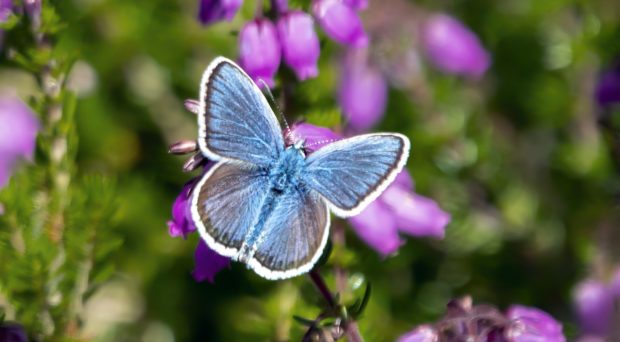
The monitoring of butterfly abundance provides an important indicator for how invertebrates are responding to habitat and climate changes. Butterflies are relatively easy to monitor, and respond quickly to changes, with at least one generation per year.

Butterfly abundance is monitored in the UK by the UK Butterfly Monitoring Scheme (UKBMS). The UKBMS has been running since 1976 and consists of a network of transects which volunteers walk weekly throughout April to September each year and count the butterflies seen. In 2018, counts from almost 3000 transects contributed to the scheme. From these data, national and UK trends and abundance indices are calculated annually for 56 of the 59 butterfly species occurring regularly in the UK.
A new method has been developed which enables butterfly abundance trends to be calculated for small regional areas, such as an English county. Traditionally methods rely on a large number of transects being walked, which is not always available at the local level, especially for some of the rarer species.
Since a proportion of weeks in the monitoring season are naturally missed, for example due to poor weather, producing indices of abundance from butterfly count data requires the estimation of species’ flight periods in order to estimate these missing values.
Butterfly flight periods typically vary depending on latitude, longitude and altitude
Over a large regional area, butterfly flight periods typically vary depending on latitude, longitude and altitude. However, over a smaller spatial region, the flight period can be assumed to be approximately the same. Estimating species’ flight periods from noisy data from potentially a few transects may not be reliable. Hence assuming that species’ flight periods are the same in any given year, the new method uses butterfly records from all sources, to estimate the flight period for each species. Other sources of data may include records from more casual citizen-science sources and opportunistic recording, which are typically available in greater quantity than more structured counts from transects.
The new method involves calculating a so called Dummy site, which depends on the estimated flight period of each species. This Dummy site is then used as an aid in fitting a curve to the abundance data. Analysis has shown that the Dummy site enables a better curve to be fitted to the data, than other methods. The accuracy of this curve is an important element in calculating a site abundance index. Regional abundance indices for each species were calculated from the site indices, and estimated trends in the regional indices provide summaries of changes in species’ abundance, for varying numbers of years.
Comparison with other methods showed that the new method was able to produce more robust and realistic results. Maximising the data used has the benefit of allowing more valuable records collected by volunteers to contribute to abundance trends, which is especially important when data are limited.

Of the 43 Surrey butterflies species resident in 1986, it was not possible to calculate a regional index for Purple Emperor, Small Pearl-bordered Fritillary, Small Skipper, Wall and White Admiral. And it was not possible to calculate a trend for Duke of Burgundy and Pearl-bordered Fritillary. Of these 7 species, 4 have been lost from Surrey during the period.
In the early years there were only a few transects walked in Surrey, so it was only possible to calculate 30 year trends with confidence limits for 23 resident species. As the number of transects increased with more species being monitored, it was possible to calculate 20 year trends with confidence limits for 33 residents, increasing to 35 species with 10 year trends.

The analysis has shown for the first time that those butterflies that are at greatest risk of extinction from Surrey are Silver-studded Blue and Grayling. They were lost from the calcareous grasslands of the North Downs during the late 1950s, and now only survive on the heathlands. This will enable conservation work to be targeted where it is needed most at the local level.
The method can be applied to other regions, and to other insects with suitable data sets. Using data from sources, other than formal monitoring records to estimate species’ flight periods, could also benefit newly established or small-scale monitoring schemes.
Click here to read the full article published in the Journal of Insect Conservation.

Harry Clarke & Dr Emily Dennis
Dr Emily Dennis is a senior ecological statistician at Butterfly Conservation in the UK. Her research focuses on developing novel statistical methods for analyzing citizen science data sets, particularly for butterflies and moths.
Latest posts by Harry Clarke & Dr Emily Dennis (see all)
- New method helps target local butterfly conservation efforts - 20th July 2020
Comments